Greenfrastructure: Beitou Public Library (Taiwan)

[fblike]

Beitou Public Library Going Green

The use of wood is significant. If taken from managed forests rather than primary or rain forests, it is a far greener material than concrete. Cement takes a great deal of energy to extract, heat, mix and refine. Also, the extraction of gravel for use as a concrete aggregate has damaged many of Taiwan’s rivers and hillsides.
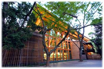
{Exterior of the library. © Culture Taiwan}

{Interior of the library.  © Culture Taiwan}

Ying-chao Kuo (郭英釗), one of the architects who worked on the project, explains that the timber for Beitou Library was sourced from North America. It could not be obtained from anywhere nearer because logging has been effectively banned in Taiwan, and forests in Southeast Asia are not managed in a sustainable manner.

Taiwan’s hot, humid climate and insect population can be brutal for wooden structures. But rather than treat the materials with strong chemicals that might later contaminate the environment, wood oils were used to protect the timber from rotting and infestation, says Kuo, one of the partners of the Taipei-based firm Bio Architecture Formosana (九典建築師事務所), the designers of the library.

{Its large windows reducing need for air-conditioning or light in the day. © Culture Taiwan}

The library’s large windows help cut electricity use in two ways. An abundance of natural light means less interior lighting is needed. Also, the windows can be opened to provide ventilation, so reducing the need for fans and air-conditioning.

One part of the roof is covered by photovoltaic (PV) cells that are expected to convert sunlight into at least US$1,000 worth of electricity per year. Another part is covered by a 20-centimeter-thick layer of soil that provides thermal insulation. During Taipei’s chilly winters, the soil cuts heat loss through the ceiling and thereby makes the interior cozier. In the summertime, the foliage blocks some of the warmth of the sun.

{Enjoying a leisurely read close to nature. © Katie Yang}

Some plants take root and thrive on the roof, improving air quality in the immediate area.

The library conserves water by capturing rainfall. The sloping roof gathers rainwater, which is then stored and used to flush the library’s toilets.

Source: Culture Taiwan

Greenfrastructure: (Home) Solar Bottle Bulb

[fblike]

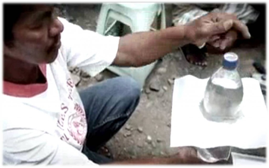
As simple as it sounds, a one-liter plastic bottle filled with purified water and some bleach could serve as a light bulb for some of the millions of people who live without electricity. Originally developed by MIT students, the “solar bottle bulb” is now being distributed by the MyShelter Foundation to homes throughout the Philippines. The foundation’s goal is to use this alternative source of daylight to brighten one million homes in the country by 2012.”

{Making solar bulbs with the use of recycled materials.  © Physorg}

This shows us that sustainable urban infrastructure and design do not have to be expensive or rely completely on technological advancements. Even little inventions using everyday materials like a soda bottle can make a different to people’s lives in developing countries like the Philippines without breaking the bank or adding onto the environmental baggage.

Making use of the earth’s natural resources, rather than electricity to light up our world.

*Watch the video and be amazed.

Henderson Waves (Singapore)

[fblike]

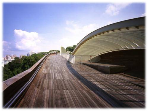
{Henderson Waves  © designboom}

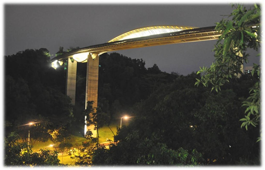
Henderson Waves – nature walkways constructed high in the foliage of the treetops allow visitors to both indulge in the occasional experience with nature away from the traffic, without actually leaving the city altogether. Instead of going far away from the city centre, these walkways allow city dwellers to go far higher from the hustle and bustle of city life.

I’m personally a fan of Henderson waves, because it’s situated conveniently in the heart of the island, where it’s equally accessible to people from all sides of the island. it’s also especially close to the CBD area where all the most stress and workaholics reside. people like bankers and accountants and businessmen who are often on-the-go and on-the-ball practically 24/7can make use of this walkway to get away abit without actually losing (phone) connection with their urban life.

{Henderson Waves overlooking Telok Blangah Road © Eustaquio Santimano}

However i think we don’t really put our treetop walks to good use. often i ask my friends along for a walk they decline, suggesting alternative air-conditioned and more “down-to-earth” places to hang out at. it’s really a lot to do with singapore’s weather i think, it gets unbearably hot and humid up there if you happen to be there at the wrong time of the day, or the year. that’s probably what puts singaporeans off from really utilizing this urban “linear ribbon” of green escape to it’s fullest.

Urban Parks – Little Guilin


[fblike]

Little Guilin (“Xiao Guilin”)

{Little Guilin’s sign. © Slow Rider}

{The scenic view of guilin’s cliffs. © Slow Rider}

Area scan of Little Guilin (“Xiao Guilin”)

Constructed from a disused granite quarry, Bukit Batok Town Park is commonly known as “Little Guilin” or “Xiao Guilin”, after the scenic spot in China. Comprising 42 ha of land, it is located at Bukit Batok East Avenue 5. The name “Bukit Batok” has been suggested to be derived from the noise made by the blasting in the granite quarry that now form the natural surroundings of Little Guilin.

The Housing and Development Board had originally intended to fill the quarry up and build a road on it in 1984. It was converted to a pond instead when it was realized that the existing quarry had rugged granite outcrops and a contrasting backdrop of green hills that gave it a pleasant look. The surrounding areas were also beautified and made accessible by placing granite blocks on the retaining walls and adding footpaths, lights and seating.

{Fishing! © Serene Ng}

In 1996, the Urban Redevelopment Authority (URA) conceptualised the Development Plan Guide for Yishun and Bukit Batok, which proposed the use of the surrounding parks to enhance the residential landscape for the area. It also proposed links between the Town Park and Nature Parks, and eventually linking them via park connectors to the Bukit Timah Nature Reserve and Sungei Pandan.

Besides being used for exercise and walks, the town park has also been used as a stage for Chinese opera, dance and music performances.

 Source: Little Guilin (“Xiao Guilin”)

Urban Parks – Lorong Halus Wetland Park

[fblike]

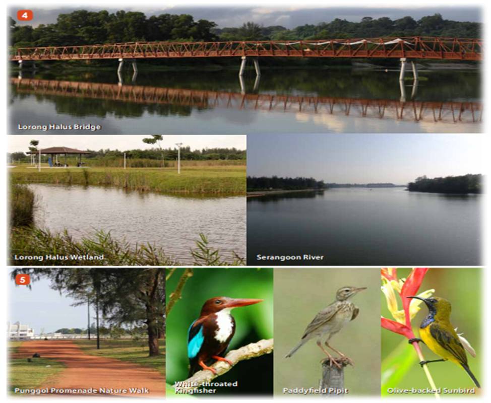
{Some of the inhabitants you can catch at Punggol Promenade & Lor Halus Wetland Park if you’re lucky! © NParks}

Located along the eastern bank of Serangoon Reservoir, Lorong Halus Wetland was transformed from a landfill into a haven for biodiversity. Spend some time exploring this wetland that spans the area of 18 football fields! Visitors entering Lorong Halus Wetland from Punggol Promenade will be greeted by the elegantly designed Lorong Halus Bridge, which is a charming addition to the natural surroundings. It is also part of the North Eastern Riverine Loop that aims to bring the public closer to the natural environment – vegetation and water.

{Lor Halus Bridge at sunrise. © Tze Ru Pang}

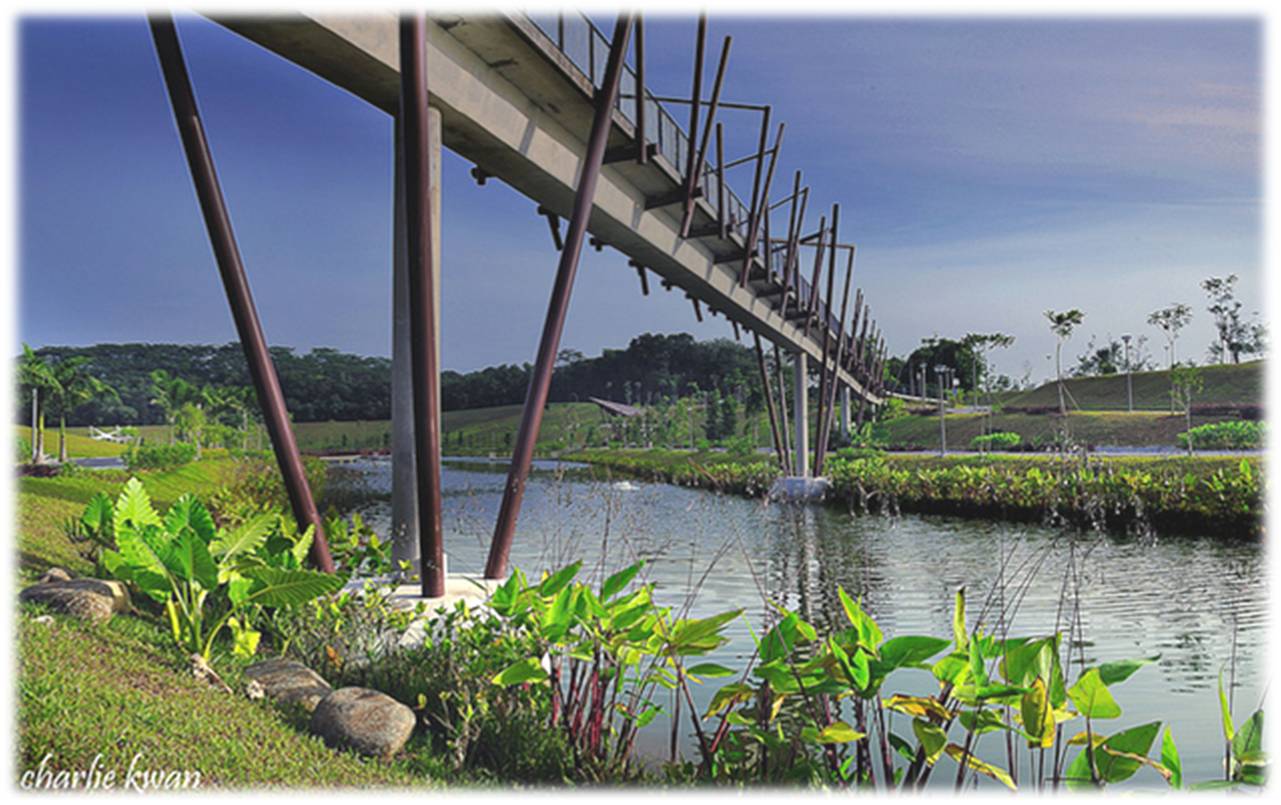
“Usually pedestrian bridges in Singapore are carried out as pile and beam bridges and henceforth tend to look heavy. In this case a more filigree truss structure was chosen. Five 30m long compartments span between concrete piles with steel caps. The number of piles into the riverbed was decreased by the greater span, reducing the impact on the bridge’s natural environment to a minimum. 

The pedestrian bridge is lit up with ultra-efficient 10W LED linear lighting bars, replacing the conventional method of using fluorescent lights.” (Source: World Architecture News)

Having personally been to the Punggol Promenade, crossed the Lorong Halus Bridge, and cycling through the Lorong Halus Wetland that links you all the way to Pasir Ris, I have to say that it is a really beautiful space of greenery and artfully constructed footpaths which are made from light gravel and pebbles blends perfectly into the natural landscape, and that, makes your walk all the more enjoyable as you feel like part of the natural environment. When it first opened, there were few visitors, only a sprinkling of adventurous cyclists like myself, and landscape photographers who were there to take advantage of the abundant sunlight and vast space. Since then, on my frequent visits back, both on my bike or on foot, I’ve seen parents bringing their children for a day out exploring the biodiversity of the area, and reading from the informative signages about the Wetland and its inhabitants. I’ve also seen couples, young and old, taking strolls in the evenings.

{People coming back from the Lor Halus Wetland Park via the Bridge. ©  Slow Rider}

Converting this area into a wetland, at close range to all the HDB flats makes it a great escape for us city people. Despite being located in close proximity to the residential areas, when you’re strolling along Punggol Promenade or Lorong Halus Wetland, you practically feel as if you’ve travelled out of town to the countryside, the feeling you get is of a well-maintained Pulau Ubin, without the inconvenience of a bum-boat ride (as enjoyable old school as it may be :D). Only a stone’s throw and a short walk away from our homes, there is such an expanse of greenery and wealth of biodiversity – our dose of interaction with the natural environment made convenient. Beautiful.

If you’re interested in exploring the Lorong Halus Wetland Park, along with the rest of the equally attractive spots along the North Eastern Riverine Loop, do check this extremely comprehensive NParks guide out.

Urban Parks (Perth)

[fblike]

Kings Park & Botanic Gardens is a popular park in Perth, Australia. The Botanic Gardens and Parks Authority is committed to promoting appreciation, understanding and knowledge of our unique biodiversity and in motivating visitors to join with us in its conservation. Kings Park is known for its wide array of flora, fauna and fungi, and the parks’ natural beauty and close proximity to the city centre draws locals and tourists all year round.

They also provide free guided walks and hands-on activities about sustainable planting practices, as part of their efforts to educate visitors about conserving endangered and rare plant species and the relevance of the natural environment in our lives.

Lotterywest Federation Walkway

Incidentally, they have a tree-top bridge, one with a concept similar to that of Singapore’s Henderson Waves and also NYC’s High Line, where even walking among the canopies of the forest, you can still catch a good view of the city and the urban developments of the city. The elevated walkway and glass arched bridge are together a fusion of sculpture, architecture and engineering. Forged from richly rusted steel, the elevated steel boardwalk is a striking artwork designed to blend into the landscape so the focus is on the natural and inspiring vistas surrounding you.Such urban infrastructure are at the forefront of sustainable urban development and the efforts at building environmental awareness amongst urban dwellers – where the city dwellers can get in touch with the natural environment without completely removing themselves from their urban sensibilities.

{Lotterywest Federation Treetop walkway. © BGPA}

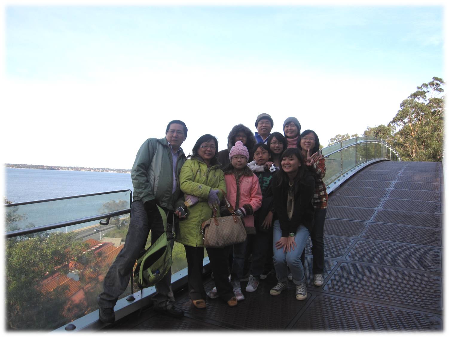
My family and I had actually visited Kings Park when we were holidaying in Perth a couple of years back, and the natural beauty of the park and the beauty of the city landscape from the Treetop Bridge had truly made an impression.

{Posing for a shot on the Glass Bridge © Priscilla Gan}

{A clear view of the city skyline from the bridge! © Priscilla Gan}

Urban Parks – Punggol Waterfront

[fblike]

Punggol Waterfront 

{Punggol Waterfront map. © NParks}

The best ways to experience the waterway would be by walking or cycling. So come join us on a virtual tour of this unique waterway. Starting from the east of the waterway, which boasts a landscape theme that is green and rustic you will be transported to a bushland like setting where peace and tranquility surround you. As you stroll along the waterway, you will arrive at the sunrise bridge. Elevated above vegetation, this bridge is the perfect spot to watch the sunrise and also presents many opportunities for photography enthusiasts.

Traveling along, you will be impressed by the landscape along the promenade. There will be inter-twining footpaths, meandering cycling tracks, streams and landscape features that blend in with undulating hills, reinforcing the rustic charms of nature.

As you head further west along the track, there is also an option to hire bicycles and up the pace of your journey while getting a good workout at the same time. As you enter the Town Park, you will experience open green spaces in the form of the Green Gallery, where budding artists can create works of art, while soaking in nature’s beauty.

A highlight of the journey would have to be the pedestrian ‘kelong-like’ bridge which recaptures the idyllic mood of old Punggol with its quaint villages. The bridge leads to a heritage trail that follows the original alignment of the existing Punggol Road. The existing vegetation will preserved and the heritage of Punggol would be depicted along artificial rock walls feature alongside the trail.

Not only does the design bring water closer to people, it brings history up close as well.

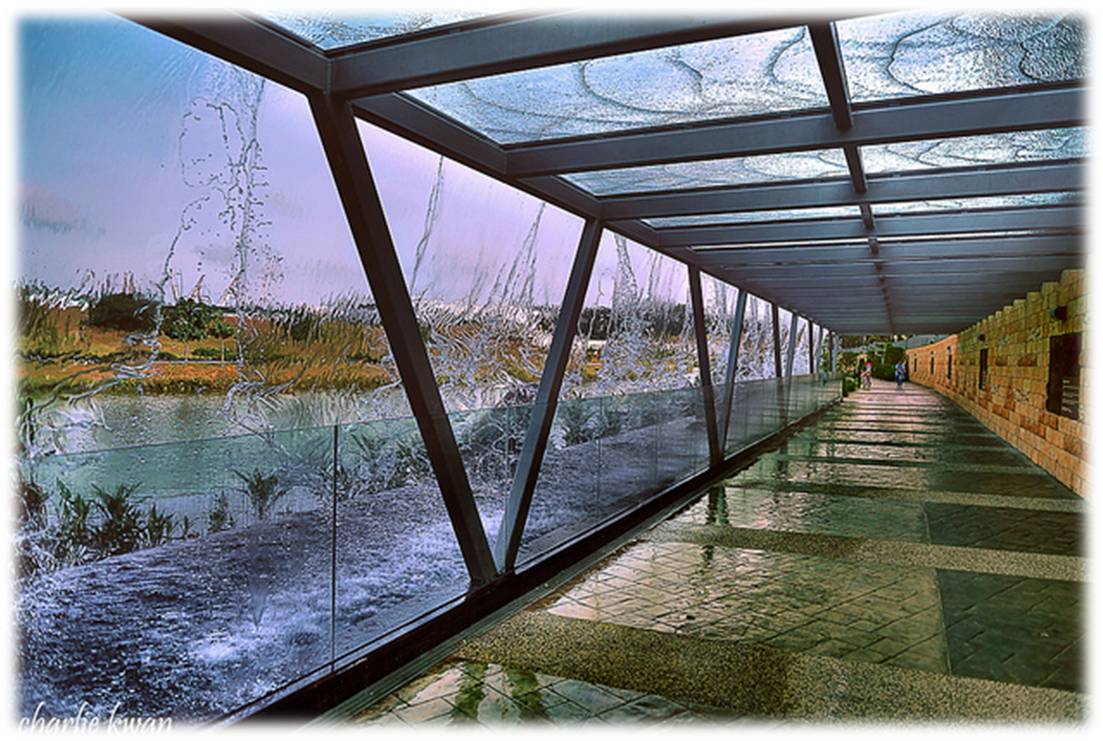
Just ahead in the water play cum sand area, families can look forward to spending weekends soaking up the sun while their children learn and have fun through water based play. As you cast your eyes across the waterway, you will notice streams of water cascading down from the bio-pond, presenting a picture perfect nature sanctuary that adds to the appeal of this waterway.

Source: We Love Punggol

{One of the bridges © Charlie Kwan}

{One of the bridges © Charlie Kwan}

{Pathway under the Waterfall. © Charlie Kwan}