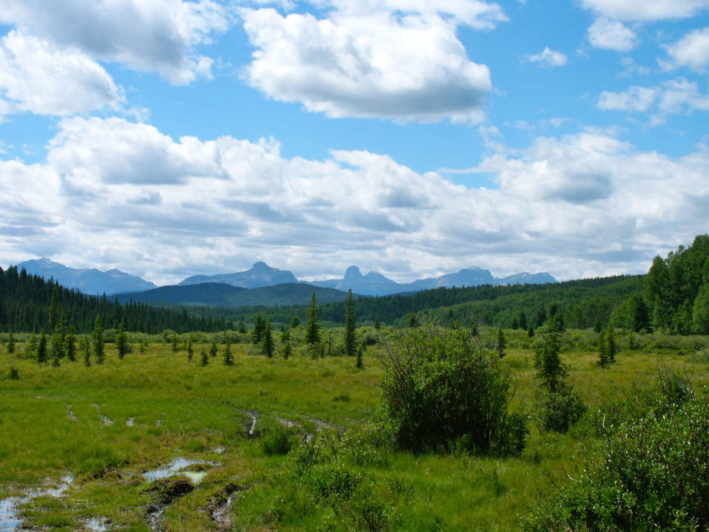
An established designated wilderness area in the year 1967, the Ghost River Wilderness area, located in the province of Alberta, is a region with minimal human activities and land is kept in a natural state. This 153 km2 area was named after the Ghost River running through it and is one out of three wilderness areas in Canada. This critical watershed provides water resources for 1.6 million people in Calgary.
Watershed Ecological Capacity: 2013 Alberta Floods
Environmental challenges have brought about a fair amount of change and damage in Ghost Valley. With heavy rainfall and rapidly melting alpine snow, the June 2013 record-breaking flood was the costliest natural disaster in Canadian history. The ghost watershed was approximated to contribute 30% of volume to the total flow and the extensive damage to the area was beyond just utility outage. The torrent swept away two homes and a dozen homes were shattered.
Forestry: Clear-cut Logging Project
Just as the Ghost Valley was still reeling in from the damage they felt, concerned residents gathered to question the increase in truckloads within the short timeframe. Residents also raised concerns about the speed of development, watershed damage and effects on tourism.
In 2001, the signing of the Forest Management Agreement gave forestry rights to Spray Lake Sawmills, a forestry and logging company, for 20 years. Despite a clear indication in the agreement that the main use is “to establish, grow, harvest, and remove timber,” there was an accelerated effort in November 2015 to begin a two-year clear-cut logging project near the Ghost-Waiparous area.
Although this 25-year harvest previously planned and approved, residents express feelings of overwhelming.
“It’s too much at once, I wouldn’t have a problem with them taking it off over 20 years.” – Willow Balkwill, 2015.
Residents felt that the logging process was advanced from a two decades effort to just two years. They are alarmed by the expansion in the scope of the operation – rapidly crossing areas with that provide ecological services and places with rich in biodiversity. Flood mitigation capacity could be reduced.
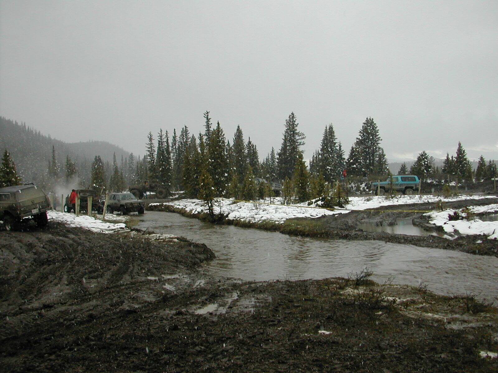
Off-Highway Vehicle Use
The clear-cut logging in Ghost River and its vicinities also linked another threat to Ghost’s River watershed’s ecological capacity – insufficient management of Off-Highway Vehicle (OHV) Use. The Ghost-Waiparous operational access management plan was meant to suggest solutions to tackle OHV, but balance the role in secure the sustainability of public land and resources. Nevertheless, an inadequate effort led to “lawless motorised mayhem”.
A sample of the damage that can be done by off-highway recreation to the creek bed and surrounding riparian habitat.
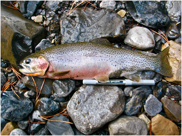
The increase in OHV access is interlinked to the clear-cut logging project. Building road necessitates the harvest of timber from the valley, however, it increases the access of OHV and lessens the water-absorbing capacity to cope with floods. Consequently, the unofficial OHV trails also compromise the wildlife habitat for threatened-species – Westslope Cutthroat Tout.
Reference: https://albertawilderness.ca/wp-content/uploads/2018/04/20150000_wsct_evan_thomas.png
Click the arrow to go to the next page.
